|
The village of Le Landin is a small village located north of France. The town of Le Landin is located in the department of Eure of the french region Haute-Normandie. The town of Le Landin is located in the township of Routot part of the district of Bernay. The area code for Le Landin is 27363 (also known as code INSEE), and the Le Landin zip code is 27350.
Geography and map of Le Landin :
The altitude of the city hall of Le Landin is approximately 138 meters. The Le Landin surface is 3.15 km ². The latitude and longitude of Le Landin are 49.401 degrees North and 0.801 degrees East.
Nearby cities and towns of Le Landin are :
Hauville (27350) at 2.16 km, Honguemare-Guenouville (27310) at 3.58 km, Barneville-sur-Seine (27310) at 4.03 km, Jumièges (76480) at 4.05 km, Le Mesnil-sous-Jumièges (76480) at 4.34 km, Bouquetot (27310) at 4.47 km, Heurteauville (76940) at 5.10 km, La Haye-de-Routot (27350) at 5.26 km.
(The distances to these nearby towns of Le Landin are calculated as the crow flies)
Population and housing of Le Landin :
The population of Le Landin was 151 in 1999, 160 in 2006 and 167 in 2007. The population density of Le Landin is 53.02 inhabitants per km². The number of housing of Le Landin was 73 in 2007. These homes of Le Landin consist of 63 main residences, 5 second or occasional homes and 5 vacant homes. |
|
|
Hotel Le Landin
|
|
|
Book now ! Best Price Guaranteed, no booking fees, pay at the hotel with our partner Booking.com, leader in online hotel reservation.
Find all hotels of Le Landin : Hotel Le Landin
| |
|
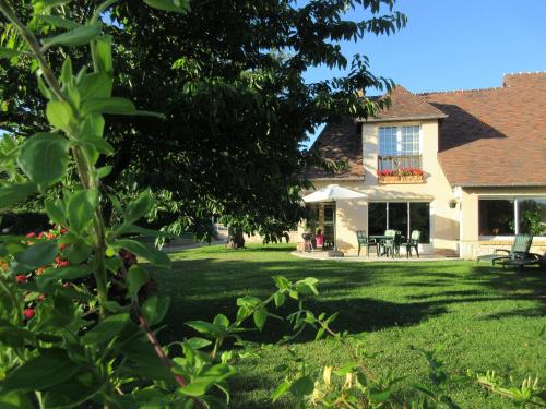
Guest accommodation : Serenity
Serenity is a detached holiday home with a terrace, set in Le Landin. You can fire up the barbecue for a tasty meal and enjoy the garden in fair weather. Free private parking is...
Rate : from 93.00 €
to 120.00 €
Address : 23 rue de la foulerie 27350 Le Landin
Distance Guest accommodation - Le Landin : 0.06 km
|
|
|
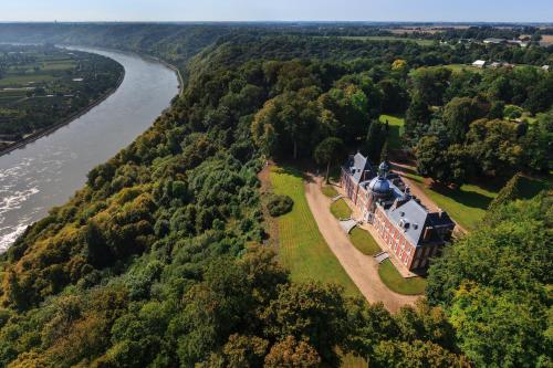
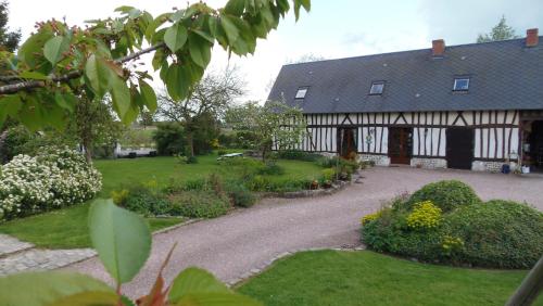
Bed and Breakfast : Chateau Du Landin

Chateau Du Landin is a property dating back to 1756, set in Le Landin, on the edge of Brotonne Forest. Views of the Seine River and Jumièges Lake can be enjoyed while relaxing i...
Price : from 145.00 €
to 165.00 €
Contact : 1 Allée du Château 27350 Le Landin
Distance Bed and Breakfast - Le Landin : 0.65 km
|
|

|
Apartment : Appart Privé dans le Château du Landin

Appart Privé dans le Château du Landin is situated in Le Landin and offers free bikes. Providing free WiFi, the property also has a garden. The apartment is composed of a fully...
Contact : allee du chateau du Landin 27350 Le Landin
Distance Apartment - Le Landin : 0.65 km
|
|
|
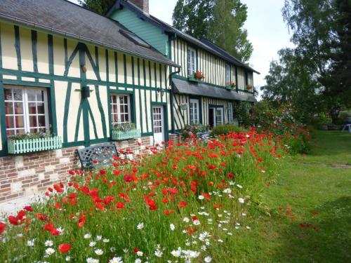
Bed and Breakfast : Chambre d'hôtes Au Fil De L'eau
This authentic Normand house is surrounded by an orchard and situated in front of the River Seine. It offers a terrace so guest can enjoy the sun in the warmer weather. Each ro...
Rate : from 85.00 €
to 145.00 €
Contact : 1351 Le Conihout 76480 Jumièges
Distance Bed and Breakfast - Le Landin : 1.39 km
|
|
|
Guest accommodation : Gite De La Balle De Golf
Situated in Jumièges, just 2.4 km from Jumièges Abbey, Gite De La Balle De Golf features accommodation with barbecue facilities and free WiFi. This holiday home offers a garden,...
Address : 600 Rue De La Haute Ville 76480 Jumièges
Distance Guest accommodation - Le Landin : 3.00 km
|
|
|
Bed and Breakfast : Chambres d'Hôtes Au Temps Des Cerises
Located in the Haute-Normandie region of France, Au Temps des Cerises is 25 km west of Rouen. It offers soundproofed rooms with a TV, private bathroom and free Wi-Fi access. At...
Prices : from 57.00 €
to 64.00 €
Contact : 924 Route Du Mesnil 76480 Jumièges
Distance Bed and Breakfast - Le Landin : 3.14 km
|
|
|
Bed and Breakfast : Chambre Du Panorama
Set in Barneville-sur-Seine, Chambre Du Panorama features free WiFi, and guests can enjoy a garden and a terrace. The accommodation comes with a flat-screen TV and a private ba...
Rate : from 59.00 €
to 84.00 €
Contact : 517 chemin des côtes 27310 Barneville-sur-Seine
Distance Bed and Breakfast - Le Landin : 3.31 km
|
|
|
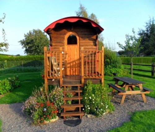
Guest accommodation : La Roulotte du Verger
Located in Barneville-sur-Seine, La Roulotte du Verger offers self-catering accommodation in a traditional wooden caravan. It is in the middle of an orchard and the property off...
Price : from 90.00 €
Contact : 517 Chemin des Côtes 27310 Barneville-sur-Seine
Distance Guest accommodation - Le Landin : 3.32 km
|
|
|
Guest accommodation : La Bonne Famille
Set opposite Jumieges Abbey, this guest house is a 5-minute drive from Jumièges leisure park and golf course. It offers an on-site tearoom with a terrace and a traditional, Bret...
Prices : from 40.00 €
to 75.00 €
Address : 107 rue Guillaume Le Conquérant 76480 Jumièges
Distance Guest accommodation - Le Landin : 3.75 km
|
|
|
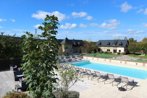
Hotel : Le Clos Des Fontaines
Set in an apple orchard, Le Clos Des Fontaines is housed in a charming half-timbered building. Enjoy peaceful, spacious rooms with luxurious furnishings and access to an outdoor...
Rate : from 114.45 €
to 332.85 €
Contact : 191 Rue Des Fontaines 76480 Jumièges
Distance Hotel - Le Landin : 3.84 km
|
|
Find another hotel near Le Landin : Le Landin hotels list
|
Map of Le Landin
|
|
Map of Le Landin :
At right you can find the localization of Le Landin on the map of France. Below, this is the satellite map of Le Landin. A road map, and maps templates of Le Landin are available here : "road map of Le Landin". This map show Le Landin seen by the satellite of Google Map. To see the streets of Le Landin or move on another zone, use the buttons "zoom" and "map" on top of this dynamic map.
Search on the map of Le Landin :
To search hotels, housings, tourist information office, administrations or other services, use the Google search integrated to the map on the following page : "map Le Landin".
Hotels of Le Landin are listed on the map with the following icons: 
The map of Le Landin is centred in the following coordinates :
|

|
|
|
|
Print the map of Le Landin

Print the map of Le Landin : map of Le Landin
|
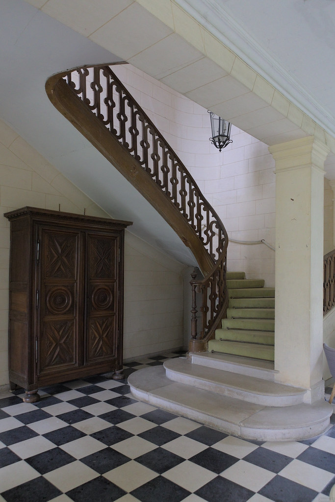
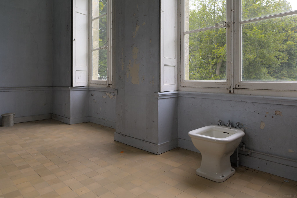
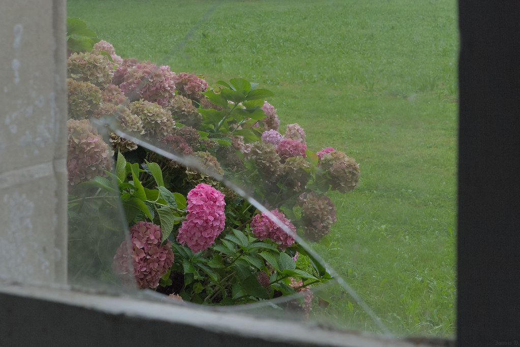
Photos Le Landin
|
See all photos of Le Landin :
Other photos of Le Landin and nearby towns can be found here: photos Le Landin
|
|
Le Landin weather forecast
Find next hours and 7 days weather forecast for Le Landin here : weather Le Landin (with english metrics)
This is the last weather forecast for Le Landin collected by the nearest observation station of Routot.
Week Forecast:
The latest weather data for Le Landin were collected Friday, 31 July 2026 at 08:02 from the nearest observation station of Routot.
| Friday, July 31st |
25°C 15°C
99%
72%
|
Drizzle
Temperature Max: 25°C Temperature Min: 15°C
Precipitation Probability: 99%
Percentage of sky occluded by clouds: 72%
Wind speed: 14 km/h East
Humidity: 65%° UV Index: 5
Sunrise: 06:27 Sunset: 21:39 |
|
| | Saturday, August 1st |
25°C 11°C
0%
52%
|
Partly cloudy
Temperature Max: 25°C Temperature Min: 11°C
Precipitation Probability: 0%
Percentage of sky occluded by clouds: 52%
Wind speed: 10 km/h South-East
Humidity: 54%° UV Index: 5
Sunrise: 06:28 Sunset: 21:37 |
|
| | Sunday, August 2nd |
28°C 12°C
0%
43%
|
Partly cloudy
Temperature Max: 28°C Temperature Min: 12°C
Precipitation Probability: 0%
Percentage of sky occluded by clouds: 43%
Wind speed: 9 km/h Sout-East
Humidity: 45%° UV Index: 6
Sunrise: 06:30 Sunset: 21:36 |
|
| | Monday, August 3rd |
32°C 17°C
0%
70%
|
Mostly cloudy
Temperature Max: 32°C Temperature Min: 17°C
Precipitation Probability: 0%
Percentage of sky occluded by clouds: 70%
Wind speed: 10 km/h North-West
Humidity: 47%° UV Index: 5
Sunrise: 06:31 Sunset: 21:34 |
|
|
Attribution: 
|
|
Other maps, hotels and towns in france
Find another town, zip code, department, region, ...
Quick links Le Landin :
Make a link to this page of Le Landin with the following code :
|
|
|
 French Version : http://www.cartesfrance.fr/carte-france-ville/27363_Le Landin.html